PLACE-BASED INVESTMENT SUPPORT
What This Looks Like in Practice
We work directly with organizations to evaluate land, reduce risk, and deploy parcel-level decision systems—across policy, infrastructure, and real estate. Each engagement uses our Land-Use Capital CycleTM to turn fragmented land data, policy constraints, and stakeholder values into workable models we call "decision infrastructure".
The GIS vs. Decision Infrastructure Paradigm:
GIS: What is where?
Spatial Analysis: What does that imply?
GeoPockets: Given those implications, what should we do next—and what evidence justifies that decision?
Decision Infrastructure:
- integrate GIS with existing systems
- structure spatial data pipelines
- build decision-support dashboards
- deploy operational workflows
Typical engagements include:
- stakeholder engagement & facilitation
- data integration & spatial analysis
- workflow design
- delivering focused project-based outcomes
Legacy or contemporary GIS platform:
- integrate your preferred systems: Google, ESRI, MapBox, GISCloud
- wrap-around dashboards: pulling from proprietary, public and third-party sources
- hand-offs to other professional teams stewarding capital decisions
- enterprise-grade decision engine
Applied Workflows
- Site-characterization, comparison, and selection
- Architectural review and entitlement systems
- Location selection for direct mail
- Flood, wildfire and habitat mitigation policy enforcement and compliance
- Parcel due-diligence and acquisition screening
- Real estate purchases, negotiations and optimization
- Environmental and infrastructure constraint analysis
- Multi-agency coordination systems
- Report writing automation for budget defense and decision support
- Field-work data collection




FRAMEWORK FOR PLACE-BASED CAPITAL ALLOCATION
LAND-USE CAPITAL CYCLETM
The map is no longer the system.
From Maps to Models: Geography is treated as an input layer rather than the final deliverable. The primary value lies in the composite scoring engines, scenario trade-off analyses, and weighting models that transform raw data into defensible rankings.
From Black-Box AI to Traceable Governance: By establishing AI as an accelerator rather than the authority, the framework addresses the critical risk in high-stakes land and conservation finance: accountability. Institutional decision-makers require transparent provenance down to the individual criterion and source layer.
From Ephemeral Projects to Reusable Assets: Capturing expert judgment as reusable decision models converts institutional knowledge—often lost during personnel turnover—into persistent organizational IP.
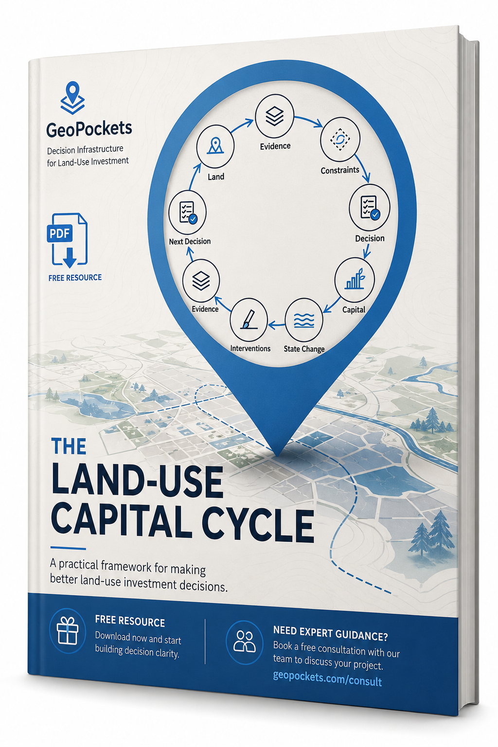
Every stage of the loop evaluates the factors needed to operationalize the Land-Use Capital Cycle™ and materially determine whether, how, when, and at what cost an investment can proceed:
- Site Geometry & Control: Parcel assemblage, ownership, title, and spatial geometry.
- Entitlements & Policy: Zoning, allowable use, and regulatory approval pathways.
- Infrastructure & Feasibility: Utility capacity, engineering constraints, and hazard exposure.
- Capital & Mitigation: Environmental remediation, community conditions, and schedule risk.
Tools & Systems
GIS & Spatial Platforms | ArcGIS (Pro, Online), QGIS, enterprise geospatial systems
Web Mapping & Application Development | React, Mapbox, Leaflet, JavaScript-based mapping interfaces
Data Integration & Spatial ETL | Multi-source data pipelines, spatial processing, and transformation workflows
Analytics & Decision Support | R, Shiny, data visualization, and applied analysis for land and infrastructure decisions
Field & Mobile Data Collection | GPS-enabled workflows, inspection tools, and real-time data capture
Cloud & Deployment Environments | Cloud-based GIS platforms, web services, and distributed system architectures
TRYING TO MOVE A PROJECT FORWARD?
SELECTED EXPERIENCE
- $20M+ Portfolio Optimization: Engineered spatial decision models that narrowed 30 candidate land acquisitions into a defensible shortlist guiding capital deployment.
- 650+ Cross-Sector Stakeholders Engaged: Led discovery, UX, and workflow validation for a 5-state, 3-tool decision platform supporting coastal restoration.
- <90-Day Enterprise Platform Delivery: Demonstrated rapid AI-assisted engineering and modular service architecture, deploying production-grade spatial engines for ~$20K.
- Structure-Centric Wildfire Risk Governance: Architected parcel-overlap registries and HIZ hazard models for mountain property risk management.
Find a Relevant Case Study for Your Project
We'll surface the GeoPockets engagement most like yours. This interactive case study finder is coming soon.